Association Boundaries
The North Anthony Area Association covers most of the residential portions of North Anthony, the historic portions of Kensington Boulevard (south of State Street), as well as Randallia, Pemberton and Niagra Drives, Morton and Garfield Streets, and portions of Woodward, Kenwood, Curdes, Vance and Crescent Avenues, along with Lawndale Drive and the portions of Lake Avenue and East State Boulevard that adjoin them. For illustration, please see the maps below.
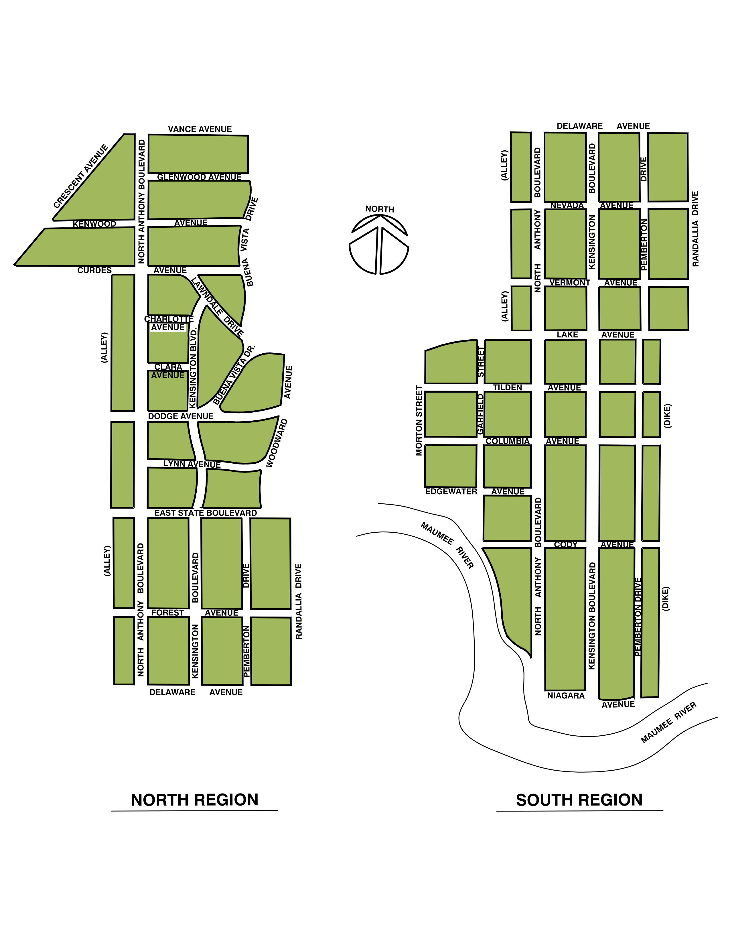
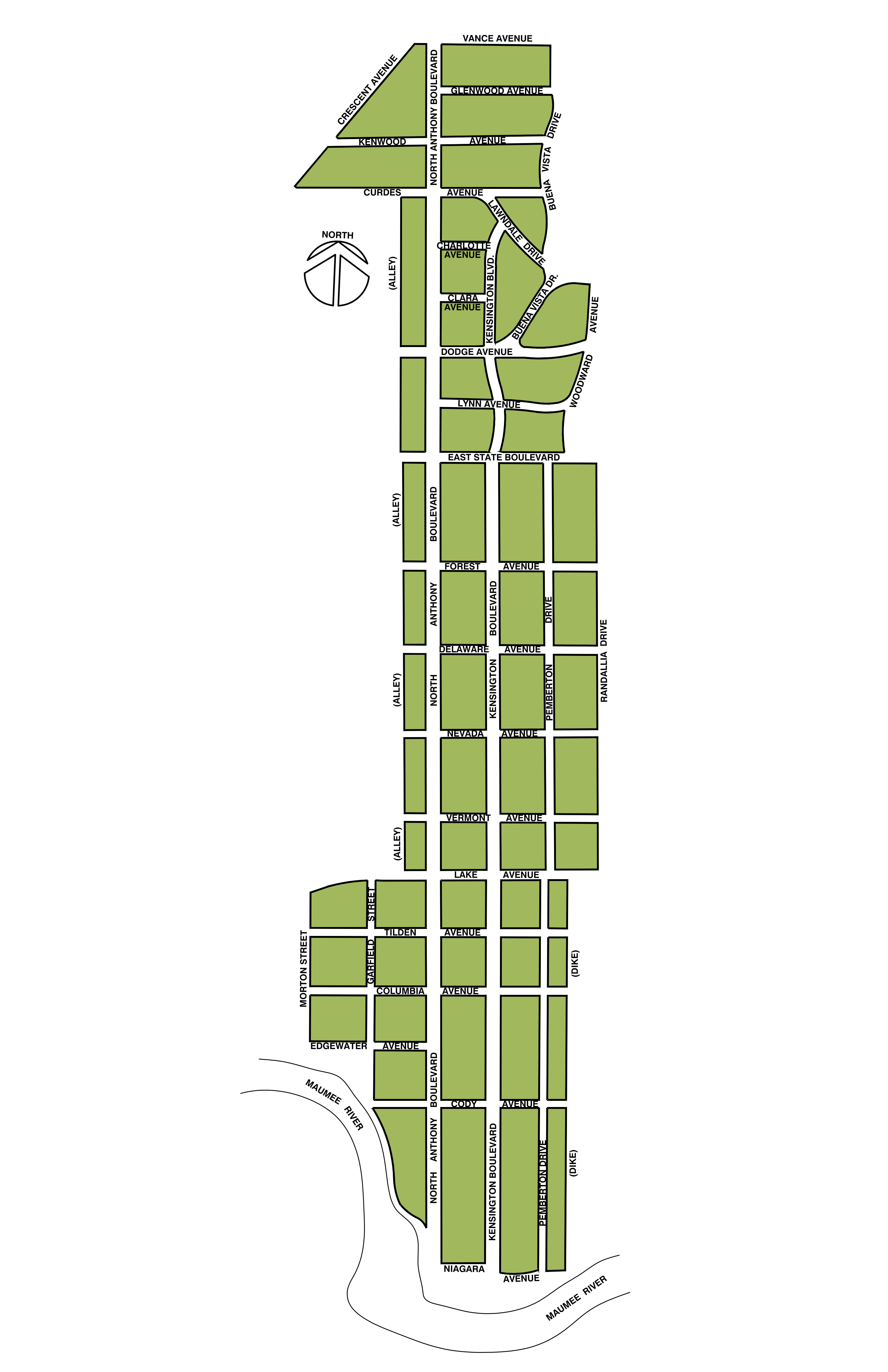
Please check our maps carefully and note whether you live in our current service area before joining. If you don’t receive our newsletter at your address, it is more than likely the case that you do not live in our service area. It is important that you live in our service area if you want to join and be eligible to vote in our elections. We will accept donations from anyone, but only dues-paying members who live within our geographic boundaries may be full voting members of our association. If you are still unsure, please feel free to contact us.